County Profiles
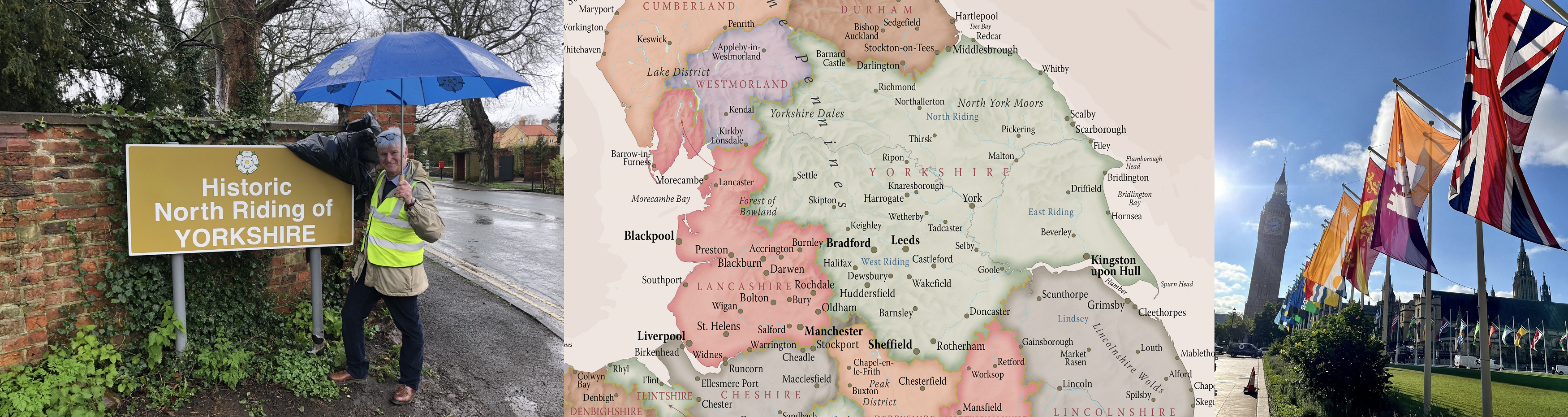
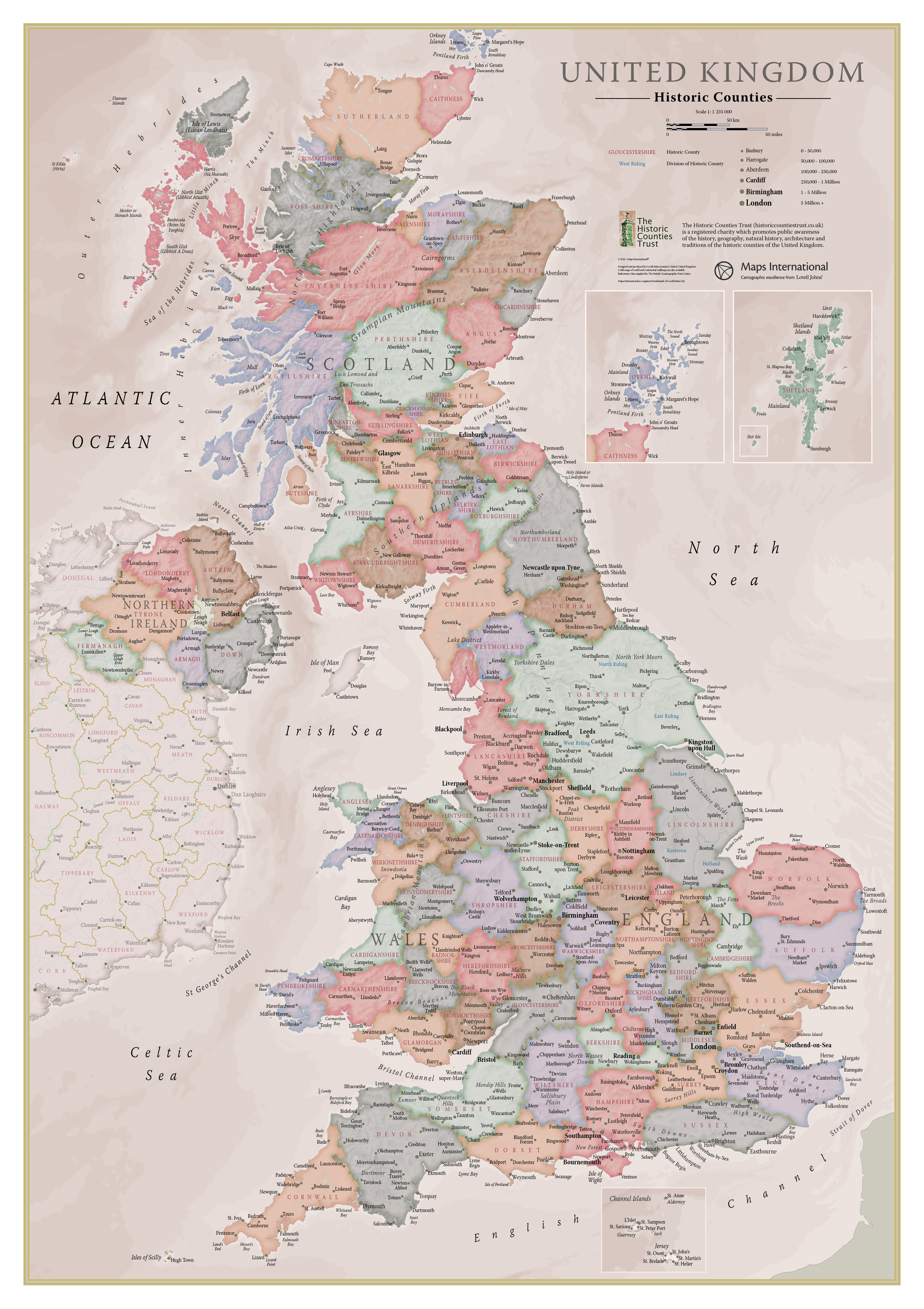
The phrase ‘historic counties’ refers to the 92 areas which, throughout most of their histories, have commonly been known simply as ‘counties’ and which have formed the standard territorial divisions of the United Kingdom for many centuries. Though formed in a variety of ways over a long period of history, the longevity of these divisions has led to them becoming an important part of the history, geography and culture of our nation.
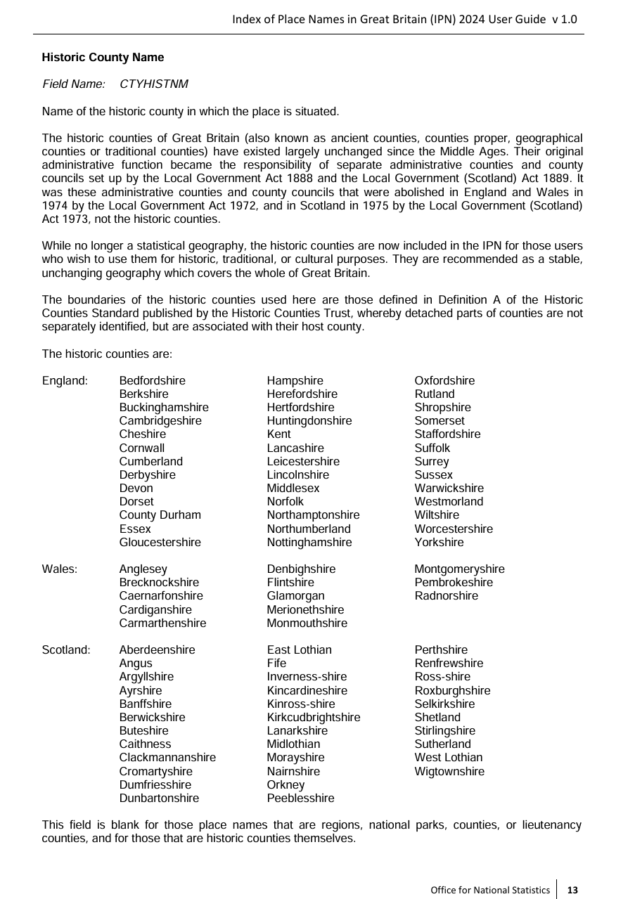
The adjective ‘historic’ has come to be commonly used in order to draw a distinction between these ancient territorial and cultural entities and the various administrative areas which have, since the 19th century, also been given the label ‘county’. There has always been an understanding that the administrative areas created by local government legislation are different in kind to the historic counties. This has been well expressed by the Office for National Statistics:
The historic counties of Great Britain (also known as ancient counties, counties proper, geographical counties or traditional counties) have existed largely unchanged since the Middles Ages. Their original adminstrative function became the responsibility of separate administrative counties and county councils set up by the Local Government Act 1888 and the Local Government (Scotland) Act 1889. It was these administrative counties and county councils that were abolished in Engand and Wales in 1974 by the Local Goverment Act 1972, and in Scotland in 1975 by the Local Government (Scotland) Act 1973, not the historic counties.
While no longer a statistical geography, the historic counties are now incluced in the Index of Place Names in Great Britain (IPN) for those users who wish to use them for historic, traditional or cultural purposes. They are recommended as a stable, unchanging geography which covers the whole of Great Britain.
An excellent description of each historic county can be found in the Gazetteer of British Place Names.
| County | Flag | Description | County Profile |
|---|---|---|---|
| Aberdeenshire |  |
Aberdeenshire is a Highland county, traditionally divided into five districts. Buchan is the most northerly. On the "Cold Shoulder" of its coast are the fishing towns of Fraserburgh and Peterhead and the "Nine Castles of the Knuckle". Formartine occupies the east of the county between the Ythan and the Don. In Ellon is the ruined 16th-century Ellon Castle. Garioch lies in the heart of the shire, around the River Ury, centred on the market town of Inverurie. To its north is Strathbogie, known for its agricultural land. Huntly Castle was the ancestral home of the Clan Gordan. Mar, the county's southern district, reaches deep into the Grampians and is famed for its castles, among them the seven-storey Craigievar Castle. At the mouth of the Dee lies Aberdeen, the Granite City, the heart of the North Sea oil business. | County Profile |
| Anglesey |  |
Anglesey (Sir Fôn) is an island county, separated from Caernarfonshire by the Menai Straits - spanned by the Britannia Bridge and the Menai Suspension Bridge. There are two main islands: Anglesey itself and Holy Island to the north-west, joined to the main isle by a causeway. The northern coast is rocky and a haven for seabirds. Elsewhere the coast is gentler and dotted with shingle and sandy beaches. Llangefni is the county's main commercial and farming town. Beaumaris has a history stretching back to Viking times. Amlwch is an 18th-century port town. Holyhead, on Holy Island, is a historic port town with a Roman fort. Elsewhere Anglesey remains a pretty, quiet and mainly Welsh-speaking county. There are many antiquities, including Beaumaris Castle and the ruins of St Dwynwen's Church. | County profile |
| Angus | - | Angus is a maritime county on the east coast of Scotland. The east of Angus is a land of rolling hills bordering the coast, along which lie Dundee - a city that grew to wealth on jute manufacture and shipbuilding; Carnoustie - famous for its Golf Links; Arbroath - with its 12th-century abbey; and the port town of Montrose. Inland lies Strathmore (The Great Glen), a broad valley used for arable produce and for grazing the famed Angus cattle. Brechin is well known for its cathedral. Forfar's history stretches back to Roman times. North of Strathmore are the Grampian Mountains. The Five Glens of Angus (Glen Isla, Glen Prosen, Glen Clova, Glen Lethnot and Glen Esk) are famed for their scenery. In the south-west of the county are the Sidlaw Hills, stretching into Perthshire. | County Profile |
| Antrim | - | Antrim is a coastal county of Ulster, bounded to the north and east by the sea, to the west by the River Bann and Lough Neagh and on the south by the River Lagan. Antrim itself, near the shore of Lough Neagh, is a modest market town. County Antrim consists of a number of distinctive areas. In the north-east, running down into the sea, are the Antrim Hills and cutting through them the beautiful Glens of Antrim. On the north coast is the Giant's Causeway, a forest of vertical hexagonal basalt columns. Inland behind the hills is the valley of the Main, with the towns of Ballymena and Ballymoney. The south is dominated by Belfast at the head of Belfast Lough and satellite towns running back to Lisburn. | |
| Argyllshire | - | Argyllshire is a maritime county of breathtaking scenery, deeply cut by sea lochs and divided into peninsulas and scattered islands stretching into the Atlantic. It encompasses most of the Inner Hebrides (including Jura, Islay, Mull, Colonsay, Coll, Tiree, Rùm, Muck and Canna) and the entire western coast of Scotland between the Mull of Kintyre and the Ardnamurchan peninsula. The lochs of mainland Argyllshire divide it into distinctive districts: Ardnamuchan, Morvern, Appin, Benderloch, Lorne, Argyll, Cowal, Knapdale and Kintyre. The whole county, mainland and islands, is mountainous. Inverary is the ancestral home of the Dukes of Argyll. Oban is the "Gateway to the Isles". Iona is famous as the centre of St Columba’s mission to bring Christianity to the Scots and Picts. | County Profile |
| Armagh | - | Armagh is an inland county of Ulster. The county is largely agricultural. There are no major rivers apart from the Blackwater separating Armagh from Tyrone, and the Newry, separating it from Down. Both rivers fall into Lough Neagh, Armagh's northern border. Between the river valleys is a more hilly district. The City of Armagh is the seat of the Primate of All Ireland; the Archbishop of Armagh. The claims of Armagh as a seat of power are part of an ancient tradition leading back to the nearby site of Emain Macha, the royal seat of the Kings of Ulster which appears in the legend of Cú Chulainn. The towns of Portadown and Lurgan, close to Lough Neagh, date from the Plantation of Ulster. Newry (partly in Down) was founded in 1144 around a Cistercian abbey. | |
| Ayrshire | - | Ayrshire is a maritime county, lying along the east shore of the Firth of Clyde. The county's traditional districts of Cunninghame, Kyle and Carrick predate Ayrshire itself. Ayrshire is one of the most agriculturally fertile regions of Scotland, the main produce being root vegetables, summer fruits, pork and cattle. The county was formerly heavily industrialised. Kilmarnock, the largest town, grew with the textile industry, with formal planned developments. Saltcoat's sandy beach makes it a popular resort. Troon is famous for its golf club. Ayr itself was established as a Royal Burgh in 1205. Scotland's aviation industry has long been based in and around Prestwick. Alloway is famous as the birthplace of Robert Burns. | County Profile |
| Banffshire |  |
Banffshire is a county on the Moray Firth. The county stretches inland up the valley of the river Spey into the Grampian and Cairngorm mountains. The interior is famed for its whisky production with Glenlivet, Aberlour, Dufftown and Keith hosting famous distilleries. The rugged mountain areas of Banffshire give way further north to more rolling country with fine glens and some areas of rich plains, running down to the coast. Banff itself, standing on Banff Bay, has many historic buildings. Nearby Duff House is one of Scotland's finest classical houses. Across Banff Bay is Macduff. Just outside is the Art Deco, seawater-filled Tarlair lido. The Old Harbour at Portsoy dates to the 17th century. Buckie, based around the 19th-century Cluny Harbour, is the county's biggest town. | County Profile |
| Bedfordshire |  |
Bedfordshire is an inland county in the southern Midlands. Outside of the main towns, the county comprises rich agricultural land, rolling rural scenery and pretty villages. The north of the county is entirely rural. Bedford itself sits in the centre of the shire on the banks of the Great Ouse. The nearby village of Elstow, birthplace of John Bunyan, has a 15th-century Moot Hall. East of Bedford lie the market towns of Biggleswade and Sandy, both on the River Ivel. The southern end of the county is swept by the chalk ridge of the Chiltern Hills. Luton lies in a break in the Chiltern Hills. Dunstable stands where Watling Street and the Icknield Way cross. Leighton Buzzard is a traditional market town on the River Ouzel. Woburn Abbey is a grand mansion with historic landscaped gardens. | County Profile |
| Berkshire |  |
Berkshire is a Royal County in southern England. The Thames forms the county's entire northern border. The north-west of the county is occupied by the Berkshire Downs along which runs the prehistoric Ridgeway. Between the Downs and the Thames is the Vale of White Horse, overlooked by the famous White Horse of Uffington. Wantage was the birthplace of Alfred the Great. The Shire Hall in Abingdon is a fine example of 17th-century Baroque architecture. The south-west of Berkshire lies in the valley of the Kennet. Newbury has many 17th-century buildings. Reading, with its ruined 12th-century abbey, lies where the Kennet enters the Thames. In the populous east of the county lie Wokingham - an ancient market town; Bracknell - a post-war new town; Sandhurst - known for its military academy; Ascot - famed for its racecourse; Maidenhead - a prosperous Thames-side town; and Windsor - dominated by Windsor Castle. | County Profile |
| Berwickshire |  |
Berwickshire is a lowland shire, along the border of England and Scotland. Berwickshire can be divided into three areas. In the north-west is Lauderdale - the long, narrow valley of the River Leader. Formerly a forest and a royal hunting ground, Lauderdale is almost completely agricultural. The north of the county lies in the bleak and beauteous landscape of the Lammermuir Hills. Greenlaw, with its impressive town hall, lies in the foothills. The Merse comprises the pastoral lands between the Lammermuirs and the River Tweed, the border with Northumberland. Duns, at its centre, abounds in historic buildings. Coldstream, once a centre for runaway marriages, lies on the Tweed. Sir Walter Scott and Field Marshall Douglas Haig are buried within the grounds of Dryburgh Abbey. The coast consists of high cliffs with sandy coves and picturesque harbours. Eyemouth is a fishing and resort town. | County Profile |
| Brecknockshire |  |
Brecknockshire or Breconshire (Sir Frycheiniog) is an inland county in Mid-Wales. Lying on the River Wye, which forms the northern border, are the market town of Builth Wells and the book town of Hay on Wye. The Cambrian mountains lie in the county's north-west. South, in the valley of the River Irfon, is the spa town of Llanwrtyd Wells. The extensive plateau of the Mynydd Epynt lies south of that. The River Usk flows eastwards through the county's central valley. In Brecon are Brecon Cathedral and the Shire Hall. The Usk flows under an elegant 17th-century bridge at Crickhowell. The Brecon Beacons National Park stretches across the south of the county: the Black Mountain range in the west; the former royal hunting ground of Fforest Fawr; the Beacons themselves and, east of the Usk Valley, the Black Mountains. The towns of the land where the Beacons meet the heads of the Valleys - Rassau, Beaufort, Brynmawr, Clydach, Gilwern - were forged by ironmaking. Cefn-coed-y-cmmer is at the head of the Taff Vale. Ystradgynlais lies on the River Tawe, in the shadow of the Black Mountain. | County Profile |
| Buckinghamshire |  |
Buckinghamshire is an inland county in the south of England. The Thames forms the southern border. On it are the pretty riverside villages of Datchet, Eton and Taplow. Slough and its suburbs form a major urban area. To its north lies the semi-ancient woodland of Burnham Beeches. Gerrards Cross and Beaconsfield lie north of the beeches. North of these, the delightful Chiltern Hills sweep north-westward across the county, with beech woods in the west, rising to higher, more windswept landscape around Ivinghoe Beacon, and all full of pretty villages of flint and thatch. The market towns of Amersham and High Wycombe lie amongst the Chiltern Hills. The Vale of Aylesbury is a large area of flat land in the middle of the county. Aylesbury has been a market town since Saxon times. Buckingham has a historic marketplace. In the county's north-east lies Milton Keynes, a 1960s new town. Bletchley was the location of Britain's wartime codebreaking activities. In the far north-east is Olney, famous for its ancient Pancake Race. | County Profile |
| Buteshire | - | Buteshire is a county made of islands in the Firth of Clyde. The Isle of Bute stands just off the Cowal peninsula of Argyllshire. On the east coast is the wee port of Rothesay and Mount Stuart House, ancestral home of the Marquesses of Bute, an impressive neo-Gothic mansion. The west coast of Bute is known for its beaches. Southward of Bute is the Isle of Arran, a mountainous island, full of wild, beautiful scenery, but sparsely populated. There are numerous Neolithic remains, including six stone circles on Machrie Moor. Holy Isle, lying inside Lamlash Bay on Arran, has a long history as a sacred site with a Holy well and the cave of 6th-century hermit St Molaise. Great Cumbrae lies east of Bute. Millport, its only town, lies on its southern coast. On Little Cumbrae, a rough and rocky island, is the Cumbrae Lighthouse (1793). | County Profile |
| Caernarfonshire |  |
Caernarfonshire (Sir Gaernarfon) is a maritime county in north-west Wales. Caernarfonshire is dominated by the mountain fastness of Snowdonia ("Yr Eryri"), in the midst of which lies Snowdon, the highest mountain of Wales. North of Snowdonia is the ancient district of Arfon, lower lying rolling countryside running down to the Menai Straits. Here stands Caernarfon - its castle overlooking the tidal rip of the straits; and the ancient city of Bangor - its cathedral a site of worship since the 6th century. The River Conwy forms most of the county's eastern border. At its mouth in Conwy itself, its castle and town walls built by King Edward I. Across the Conwy is the resort of Llandudno and the Great Orme headland, punching out into the Irish Sea. Beyond Snowdonia westwards lies the Lleyn peninsula - a place of timeless beauty of sea and land. | County Profile |
| Caithness |  |
Caithness is the northernmost county of mainland Great Britain. Bounded only by Sutherland and the sea, it lies beyond the Highlands. Caithness is a land of open, rolling farmland, moorland and scattered settlements. The county is fringed by dramatic coastal scenery, home to large seabird colonies. The landscape is dominated by open moorland and blanket bog known as the Flow Country. Wick has a wide harbour looking out onto the North Sea. The ruined Castle of Old Wick lies on the coast to the south. Thurso, on the north coast, was an important Norse port. Caithness contains the traditional north-eastern extremity of Great Britain, John O' Groats, as well as the northernmost point, Dunnet Head. The Caithness landscape is rich with prehistoric remains. | County Profile |
| Cambridgeshire |  |
Cambridgeshire is an inland county of East Anglia. The south of the county is dominated by the city of Cambridge and its ancient university. The beautiful old colleges sit on mediæval streets and their delightful “backs” look out on the banks of the River Cam. South of Cambridge is an agricultural landscape of small villages, drained by the rivers Grant and Rhee. The Gog Magog Hills are the county's highest features. The Isle of Ely, the northern part of the county, is a different world - a flat and fertile land drawn out by past generations’ labour from the Great Fen. The city of Ely stands above the fens. Ely Cathedral, the "Ship of the Fens", is visible for miles across the level fenland. North lie the Fenland market towns of Whittlesey, March and Chatteris. Wisbech has much unspoilt Georgian architecture. | County Profile |
| Cardiganshire |  |
Cardiganshire is a maritime county in west Wales, lying on Cardigan Bay. The coast is a gentle one, alternating pleasant sandy beaches and sea cliffs. Along it lie the resorts towns of Aberporth, Aberaeron, New Quay and Borth and the university town of Aberystwyth. Away from the coast, Cardiganshire rises into gentle farming country, rising up to the dramatic west slopes of the Cambrian Mountains. The Teifi forms most of the southern border, along which lie the university town of Lampeter and Cardigan, an important seaport until the Teifi silted up. The river flows past the scenic ruins of Strata Florida Abbey. Tregaron is the only town in the county's interior. | County Profile |
| Carmarthenshire | - | Carmarthenshire (Sir Gaerfyrddin, informally Sir Gâr) is a maritime county in the south-west of Wales. With its fertile land and agricultural produce, Carmarthenshire is known as the "Garden of Wales". The coast of Carmarthenshire curves around Carmarthen Bay, the quiet dip of the fields running into broad sandy beaches. Pendine Sands is seven miles long. The southern part of the county is low lying and pastoral. The north and east are mountainous. Carmarthen may be the oldest town in Wales - the Roman fort dates from around AD 75. Llanelli, the largest town, sits on the Loughor estuary. Laugharne, on the Tâf, is famous for its association with Dylan Thomas. Newcastle Emlyn, with its ruined castle, lies tucked in a meander of the River Teifi. In 930 Hywel Dda called his assembly to codify the Welsh laws in Whitland. | County Profile |
| Cheshire |  |
Cheshire is a maritime county in the north-west of England. Most of Cheshire lies in the great lowland expanse of the Cheshire Plain - stretching from the Mersey to the Shropshire Hills, from the Welsh Hills to the Peak District. The plain abounds in fine oak woodlands and small lakes or meres. The Wirral peninsula, separating the Dee and the Mersey, includes the ancient port of Birkenhead. The Roman city of Chester stands on the Dee close to the Flintshire border. Along Cheshire's northern border with Lancashire, the rivers Mersey and Tame, are many industrial and suburban towns, including Altrincham, Sale, Stockport and Stalybridge. In the north-east, the famous Cheshire 'panhandle' lunges between Yorkshire and Derbyshire. The area around Nantwich, Northwich and Middlewich has been a salt-mining area since Roman times. The county's many historic towns include Knutsford, Wilmslow, Alderley Edge, Macclesfield, Congleton and Crewe. | County Profile |
| Clackmannanshire | - | Clackmannanshire is a maritime county, lying on the north bank of the River Forth. Britain's smallest county, "The Wee County" is a countrified land of farms and small settlements. In the north are the Ochil Hills, a highlight being the imposingly sited Castle Campbell, overlooking the chasm of Dollar. At the foot of the hills, Alva and Tillcoultry grew as textile towns. The River Devon is noted for its romantic scenery and its excellent trout-fishing. South of the Devon, the land is low-lying with small towns and some industry. The county's biggest town Alloa, once a major port, lies on the Forth. Alloa Tower is one of the largest and earliest of Scottish tower houses. Clackmannan itself took its name from the Stone of Mannan, a pre-Christian monument in the town square. | County Profile |
| Cornwall |  |
Cornwall is a maritime county, forming the south-west peninsula of Great Britain. Cornwall's rugged landscape has inspired poets, novelists and artists for centuries. The north coast has plunging cliffs and rocky headlands, interrupted by fine, sandy beaches in sheltered bays. Tintagel has a long association with Arthurian legend. Port Isaac has a picturesque harbour. Dolphins may be seen from Polzeath's vast beach. Padstow is a fishing port. Newquay is a top surfing spot. Furthest west is the Penwith peninsula, with the port town of Penzance and Land's End itself. The south coast has long, twisting creeks bringing the tide deep inland, once ideal for smugglers. Looe is a delightful fishing port. Fowey has thrived as a port for hundreds of years. Falmouth is famous for its deep water harbour. The Lizard Peninsula extends into the sea where the English Channel meets the Atlantic Ocean. Inland, prehistoric megalithic dolmens, monoliths, and circles abound on the county's moors and hills. Truro has charming cobbled streets and a Gothic Revival Cathedral. | County Profile |
| County Durham |  |
County Durham is a maritime county in the north-east of England - reaching from the North Sea to the Pennines, from the Tyne and Derwent to the Tees. Known as the "Land of the Prince Bishops", the county was ruled by the Bishops of Durham until 1836. The moorlands and mountains of the Durham Dales occupy the west of the county. The south lies within the Tees Lowlands, including the industrial towns of Darlington, Stockton-on-Tees, Billingham and the port of Hartlepool. The River Wear meanders across much of the county, flowing through the ancient towns of Bishop Auckland, Durham, Chester-le-Street to reach the sea at Sunderland. The north is dominated by the towns on the Tyne’s south bank: former mining towns Ryton and Blaydon on Tyne; Gateshead – famed for architecture; the shipbuilding town of Hebburn; Jarrow - home of Bede; and the port of South Shields. | County Profile |
| Cromartyshire | - | Cromartyshire is a Highland county of highly unusual form. The mediæval "old shire" was a hereditary sheriffdom on the Black Isle peninsula on the Moray Firth, including the historic port of Cromarty itself. In the late 17th century, then-owner Viscount Tarbat managed to have his family's various lands incorporated into his sheriffdom. The result was a county in numerous small parts scattered across Ross-shire from the east to the west coast. The largest part is the district of Coignach on the Atlantic coast around the fishing village of Ullapool, an area of astonishing but stark beauty. The Summer Isles lie off the Coigach coast. The Victorian spa resort of Strathpeffer is the county's only other sizeable settlement. Geographically it has long been common to treat Cromartyshire together with Ross-shire. | County Profile |
| Cumberland |  |
Cumberland is a maritime county in the north-west of England. The county's south and east is dominated by the Lake District with its stately, forbidding fells and cool, glittering lakes. Derwent Water, Buttermere, Crummock Water, Ennerdale Water, Wast Water, and part of Ullswater lie in Cumberland. Above them rise mountains, including England's highest Scafell Pike. Castlerigg stone circle is dramatically sited, with panoramic views of the fells. The tourist town of Keswick is nearby. West of the fells is Cumberland's coastal plain with the port towns of Whitehaven, Workington, Maryport and Silloth. The broad, green Eden Valley crosses the east of Cumberland, Penrith lying close to the Westmorland border. The cathedral city of Carlisle lies in the county's north, with the Solway Plain to its north. Hadrian's Wall runs from Bowness-on-Solway across the north of the county. | County Profile |
| Denbighshire | - | Denbighshire (Sir Ddinbych) is a maritime county in north Wales. Denbighshire has a gentle, sandy coast on the Irish Sea, with a string of holiday resorts: Rhos-on-Sea, Colwyn Bay, Old Colwyn, Towyn and Kinmel Bay. Abergele originated from an old Roman trading town. In the south and west of the county are high mountains of the Cambrian range. The River Conwy forms most of the western border. The broad, fertile Vale of Clwyd comprises much of the eastern side of Denbighshire. Within it are the market towns of Denbigh, with its castle built for Edward I; and Ruthin, with its 15th-century Old Courthouse. East are the Clwydian Hills, forming the border with Flintshire. The broad south-west of the county stretches down to the county top, Cadair Berwyn, on the Merionethshire border and up to the county's largest town Wrexham, wherein St Giles' Church with its iconic 16th-century tower is a highlight. Between them, Llangollen has a famous 16th-century bridge over the River Dee. | County Profile |
| Derbyshire |  |
Derbyshire is an inland Midland county. The River Derwent runs almost the entire length of the county. From Derby up to Matlock, the Derwent was a cradle of the Industrial Revolution, the site of the first industrial-scale cotton mills. Derby itself has Roman origins but grew rapidly in the industrial era. To the south of Derby, the county is mostly rural. To its north, Matlock Bath is a Victorian spa resort. To the city's east, along the rivers Amber and Erewash, are towns shaped by mining and industry: Long Eaton, Ilkeston, Heanor, Ripley, Belper and Alfreton. In contrast, west of Derby is a large pastoral area - the rolling plateau of the South Derbyshire Claylands slopes up to the Peak District. Ashbourne is known for its Shrovetide Football Match. The Peak District occupies the north-west of the county, renowned for its natural beauty and a popular area for hiking, cycling, climbing and caving. Buxton retains its Victorian charm. Bakewell is famous for its pudding. Nearby are Chatsworth House and Haddon Hall. The towns of north-east Derbyshire, including Chesterfield and Bolsover, reflect the area's industrial and mining heritage. | County Profile |
| Devon |  |
Devon is a maritime county in the West Country of England. Devon has two seacoasts, with the Bristol Channel and English Channel. The southern coast is very lovely, rugged between Thurlestone and Salcombe, from where a network of craggy tidal creeks reaches deep into the land. Tor Bay faces east into the Channel. Around it lie the resorts of Torquay and Paignton. Inland much of southern Devon is Dartmoor, a bleak but picturesque landscape of granite hill country. Tavistock is the Queen of Dartmoor, a fine granite-built town on the Tavy. Exeter stands on the River Exe, a mixture of mediæval and modern. Plymouth has been a major naval port since the days of Elizabeth I. There is rolling agricultural land in the north and in the east of the county, particularly along the Exe and Culm Valleys. The northern coastline is remarkable for steep thickly-wooded cliffs between Lynmouth and Ilfracombe. Beyond the Taw and Torridge estuaries there is again magnificent coastal scenery around Clovelly - itself a jewel of a village. | County Profile |
| Dorset |  |
Dorset is a maritime county on the south coast of England, containing an enormous variety of landscapes. Poole owes its prosperity to Poole Harbour, a vast and deep natural harbour. To its south is the broad peninsula of the Isle of Purbeck, upon which stands the noble ruin of Corfe Castle. Swanage is a popular seaside resort. The entire coast, consisting of Triassic, Jurassic and Cretaceous cliffs, is a World Heritage Site. South of the resort of Weymouth is the Isle of Portland, connected to the mainland by the mighty Chesil Beach. At the far west of the county is Lyme Regis, "The Pearl of Dorset". Dorchester, the historic county town, lies north of Weymouth. Thomas Hardy was born in nearby Higher Brockhampton. In the county's centre are the Dorset Downs, on them the antiquities Maiden Castle and the Cerne Abbas Giant. To the north-east, Cranborne Chase has many Neolithic and Bronze Age monuments. Shaftesbury Abbey was founded by Alfred in 888. At the north of the county is the Blackmore Vale and the Saxon town of Gillingham. | County Profile |
| Down | - | Down is a county on the east coast of Ulster. Down runs from the highly urbanized, southern Belfast and its suburbs, to the wild Mourne Mountains. Down's west coast itself is the Ards peninsula, which clasps itself around Strangford Lough, bringing the sea into the heart of the county. The Lagan running down into Belfast, which lies athwart the Antrim-Down border, forms Down's northern edge. The north coast has genteel commuter towns including Bangor and Holywood. The rest of the north of the county is agricultural. In the south are the precipitous granite peaks of the Mourne Mountains, which run down to the sea at Newcastle and at Carlingford Lough, the border with Louth. | |
| Dumfriesshire | - | Dumfriesshire is a maritime county, lying along the Solway Firth. The county's rivers and lochs produce a beautiful landscape, attracting much fishing. The county lies in three great valleys running south into the Solway Firth. Eskdale, the easternmost, is rich in archaeological remains including neolithic circles the Loupin Stanes and the Girdle Stanes. Langholm is the traditional seat of Clan Armstrong. Annandale forms the main route from Glasgow to the south and, judging by the towns, old inns and even Roman forts along its length, has served that purpose for millennia. Moffat grew as a spa town from 1633. Lockerbie has several memorials to the victims of the UK's worst terrorist attack. Nithdale includes Sanquhar and Thornhill. Drumlanrig Castle was once the ancient Douglas stronghold. Dumfries itself, the Queen of the South, retains the charm which led Robert Burns to choose it as his final home. | County Profile |
| Dunbartonshire | - | Dunbartonshire is a county in the west of Scotland, split into two parts. The larger part lies along the north shore of the Firth of Clyde and northward between Loch Long and Loch Lomond. The magnificent Loch Lomond stretches from the mountains in the north to Alexandria in the south. The Rock of Dumbarton, the seat of the old Kingdom of Strathclyde, rises sheer above the town on the Firth of Clyde. Clydebank's more recent origin is in wharfs and shipbuilding, serving the vast Clyde traffic. Helensburgh is a seaside resort and location of Mackintosh's villa The Hill House. The smaller part of Dumbartonshire to the east contains the post-war new town of Cumbernauld. The Antonine Wall runs through Kirkintilloch. | County Profile |
| East Lothian |  |
East Lothian is a maritime county on the east coast of Scotland. The county's coast runs along the southern shore of the Firth of Forth and round to the North Sea. Prestonpans has a 17th-century mercat cross. Cockenzie and Port Seton has grown from what were two small fishing villages. Much of the coast is blessed with sandy beaches and a fine climate, attracting holidaymakers to the resorts of North Berwick and Dunbar. Inland, East Lothian is a generally low-lying fertile county, given to farming and fishing. Haddington has been a Royal Burgh since the reign of David I. The county is sometimes known as 'Haddingtonshire'. The southernmost part of the county is in the Lammermuir Hills, which form a great divide between the Lothians and Berwickshire. | County Profile |
| Essex |  |
Essex is a maritime county in the south-east of England. Although the south-west of the county lies within the metropolitan conurbation, the character remains of its individual towns: Stratford, East Ham, Ilford, Dagenham, Barking, Leyton and Romford. Epping Forest and Waltham Abbey lie north-west of the metropolitan area. A string of industrial towns, including West Thurrock, Grays and Tilbury, lie along the Thames estuary. Southend-on-Sea is a child of the great age of seaside holidays. Chelmsford, at the centre of the shire, dates from pre-Roman times. Colchester was for a time the capital of Roman Britain. Elsewhere the county is rural and the coast is ragged, indented by river estuaries and full of tidal marshes. In contrast are the seaside resorts: Clacton-on-Sea, Frinton-on-Sea, Walton-on-the-Naze. Harwich is a major port. Saffron Walden, in the north-west, is a jewel of Essex. | County Profile |
| Fermanagh | - | Fermangh is an inland county of Northern Ireland. The county is sparsely populated, abounding in lakes and pasture. The River Erne running through the length of Fermanagh has created two great lakes, Upper and Lower Lough Erne. Much of Upper Lough Erne resembles a scatter of low green islands with broad river channels winding at random between them. Lower Lough Erne is a broader body of water with wee islands dotted about it. Both Loughs are popular for fishing and holiday boating. Above the Loughs, Fermanagh is a wholly agricultural county. Enniskillen, the county's only sizeable town, sits between the two Loughs, where the Erne is a river again. Enniskillen Castle was built in the 15th century as a stronghold of the Maguires. | |
| Fife | - | Fife is a maritime county lying between the Firth of Forth and the Firth of Tay. "The Kingdom of Fife" sobriquet is a reference to the Pictish kingdom from which the county evolved. Fife is at its most urban at its most southerly point, where the Forth Bridges cross the Firth into the county. Dunfermline, the largest town, is in this area, as is the Royal Navy's major base and dockyard at Rosyth. Inverkeithing is an ancient port. North Queensferry was reputedly established by St Margaret, wife of Malcolm III, to ensure ferry crossings for pilgrims heading to St Andrews. Further up the coast is Kirkcaldy, an ancient trading port. Inland, the Lomond Hills lie in the centre of Fife. Glenrothes is a post-war new town. Cupar has a 17th-century mercat cross. On Fife's "East Neuk" is St Andrews, seat of one of Britain's oldest universities and the home of the Royal and Ancient Golf Club - and of the game itself. | County Profile |
| Flintshire |  |
Flintshire (Sir y Fflint) is a maritime county in north Wales. The main part of Flintshire lies along the Dee estuary and on the Irish sea. In the centre is a backbone of modest hills, the Clwydian Range, and in the north-west is the Clwyd Valley. The coast is marked with holiday resorts, notably Prestatyn and Rhyl. St Asaph, on the River Clwyd, is the seat of the ancient bishopric of St Asaph. Rhuddlan Castle was built by Edward I. On the Dee coast, Connah's Quay and Shotton developed as industrial towns in the 19th century. Inland from the Dee, St Winefride's Well at Holywell has been a site of pilgrimage since about 660. The rural Maelor Saesneg area is separated from the rest of the county by a tract of Denbighshire. The ancient yew trees in the churchyard of St Mary the Virgin in Overton-on-Dee are one of the Seven Wonders of Wales. | County Profile |
| Glamorgan |  |
Glamorgan (Morgannwg) is a maritime county in south Wales. The county contains the great cities of Cardiff and Swansea as well as many other industrial, market and resort towns. Glamorgan is a county of three contrasting localities. Across the north of the county run the Valleys, a densely populated, mountainous area with a proud industrial and mining heritage. Major towns include Aberdare, Maesteg, Merthyr Tydfil, Pontypridd and Treorchy. Historically, this area was known as Blaenau Morgannwg. The Vale of Glamorgan, an unspoilt lowland area mainly comprising farmland and small villages, stretches across the south of the county from Porthcawl to Cardiff. The Vale has the ancient market towns of Bridgend, Cowbridge and Llantwit Major and the resort towns of Penarth, Barry and Porthcawl. The western part of Glamorgan comprises the ancient district of Gower including Swansea Bay and the Gower Peninsula - a place of renowned scenic beauty and sea air. | County Profile |
| Gloucestershire |  |
Gloucestershire is a maritime county in the south-west of England. Gloucestershire has three distinct parts. The Cotswold Hills cover the east of the county, spreading into neighbouring counties. The Cotswolds are famed for the beauty of their villages and the landscape. Cotswold stone produces honey-coloured towns and villages: Bibury, Bourton-on-the-Water, Chipping Camden, Lower Slaughter, Stow-on-the-Wold, Stroud and Winchcombe. Cirencester was once the Roman town of Corinium. The Severn Vale by contrast is flat and shaped by the great River Severn, cutting deep into the shire: Gloucester is a sea port on the river, while further north is historic Tewkesbury. Cheltenham is a famous as a spa town. Bristol, the great city of the Southwest, lies astride the Avon - the border with Somerset. West of the Severn is the Forest of Dean, one of the largest surviving ancient woodlands in Britain. | County Profile |
| Hampshire |  |
Hampshire is a maritime county on the south coast of England. The mainland coast of Hampshire looks to the sea. Southampton is Britain’s greatest commercial seaport. Portsmouth is the home of the Royal Navy. Across the Solent is the Isle of Wight, famous for its Victorian resort towns (Sandown, Ryde, Ventnor), its dramatic coastline (the Needles, Tennyson Down) and peace of its unspoiled interior. Mainland Hampshire’s interior comprises picture-postcard countryside which rolls all around the traveller. At its heart is Winchester, its Norman cathedral dominating the centre of the mediæval city. In the north-east are the ancient market town of Basingstoke and Aldershot, the "Home of the British Army". Andover aside, the north-west is predominantly rural.
In the south-west is the New Forest, laid out as a hunting reserve by William the Conqueror. The western end of the coast is a string of sandy resort towns, culminating in the Victorian splendour of Bournemouth. |
County Profile |
| Herefordshire | 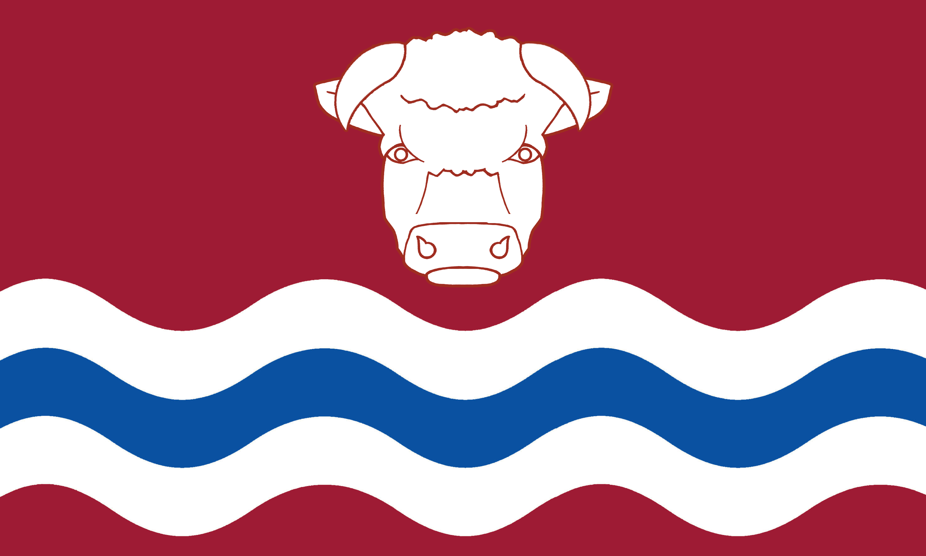 |
Herefordshire in an inland county in the Midlands, famed for its orchards and its cider. The county's major river, the Wye, runs from Clifford down to Hereford where the great Norman edifice of Hereford Cathedral stands above the river. The Wye then writhes toward Ross-on-Wye before running out of the county. The Black Mountains stretch into the south-west of the county. In their lee is the Golden Valley of the River Dore, with the majestic Dore Abbey and the famous carvings of the Church of St Mary and St David, Kilpeck. North Herefordshire is famous for its “black and white villages”, notably Leominster, Weobley, Eardisley, Kington and Pembridge. Eastern Herefordshire is a quiet, agricultural area, with the Malvern Hills rising along the Worcestershire border. Ledbury is a thriving market town. |
County Profile |
| Hertfordshire |  |
Hertfordshire in an inland county of southern England. The north-west of the county rises into the Chilterns with typical small villages and beechwoods. South-east of the Chilterns, along the River Gade lie Hemel Hempstead, Kings Langley and Abbots Langley - birthplace of Pope Adrian IV. St Albans stands on a hill overseen by St Albans Abbey. The south-west lies in the Colne Valley, the towns including Borehamwood, Watford and Rickmansworth. The River Lea dominates the east, flowing through Harpenden, Wheathampstead, Welwyn Garden City and Hertford - with its mediæval street layout. The river then becomes the Essex border and flows south past the Lea Valley towns of Hoddesdon, Cheshunt and Waltham Cross - named from the Eleanor Cross at its centre. The north of the county is mainly rural. Letchworth was the first of the garden cities and Stevenage the first post-war new town. | County Profile |
| Huntingdonshire |  |
Huntingdonshire is an inland county between the Midlands and East Anglia. Huntingdonshire is a rural county of pretty villages and a few small towns. Huntingdon itself, birthplace of Oliver Cromwell, stands in the middle of the county on the Great Ouse.
The south of Huntingdonshire is characterised by farming and picturesque villages. The Great Ouse enters Huntingdonshire at St Neots. Upstream is Godmanchester, with timber-framed Tudor houses and a mediæval bridge connecting it to Huntingdon.
The Great Ouse then flows east to St Ives, famous for its mediæval bridge with a chapel in the middle. North of Huntingdon is fenland with many small, pretty hamlets and villages. Ramsey has a manor house built on the site of an Anglo-Saxon abbey. The southern suburbs of Peterborough, including Fletton and the Ortons, occupy the far north of Huntingdonshire. |
County Profile |
| Inverness-shire | - | Inverness-shire is a huge county, the heart of the Highlands, spreading from the North Sea to the Atlantic and out into its many beauteous islands. The landward part of Inverness-shire is wild and mountainous, with isolated glens and lochs. The coastline is marked with long, rugged sea lochs. Scored through the centre of the shire is the Great Glen, running from sea to sea, from Loch Linnhe to Loch Ness - the longest, deepest and most famous of all lochs. Inverness-shire includes all of the Outer Hebrides apart from the Isle of Lewis. The shire also includes several of the Inner Hebrides: Skye, Raasay, Scalpay and Eigg. The county has more than fifty Munroes, including Ben Nevis, the highest mountain in Great Britain. Inverness, standing where the River Ness enters the Moray Firth, is considered the capital of the Highlands. Aviemore is a popular resort for winter sports and for hillwalking in the Cairngorms. Fort William, close to Ben Nevis, is a centre for hillwalking and climbing. | County Profile |
| Kent |  |
Kent is a maritime county at the south-easternmost point of Great Britain. Kent was a British kingdom before the Romans came and after them it became a Jutish kingdom. The county is known as the “Garden of England” for the richness of its arable farming. The north-west of Kent, from Lewisham and Greenwich out to Bromley, is part of the metropolitan conurbation. Rural Kent holds a great variety of landscape, from the North Downs, to the delightful Weald, down to the fertile solitudes of Romney, Denge, and Walland Marshes, and the Isle of Thanet in the north-east. The county's main towns include Maidstone, Tonbridge, Ashford and Royal Tunbridge Wells. Rochester, an ancient cathedral city, is at the lowest bridging point of the River Medway. The City of Canterbury is where St Augustine established himself in AD 597, and is the seat of the Archbishop of Canterbury. The famous White Cliffs look out over the Straits of Dover. |
County Profile |
| Kincardineshire | - | Kincardineshire is a maritime county on the North Sea coast. The north-west of the county lies in the Grampian mountains. Glen Dye is remarkable for its beauty. To the east, these slope down to the finely-wooded valley of the River Dee which forms much of the border with Aberdeenshire. Banchory is known as the "Gateway to Royal Deeside". South of the Grampians is the low-lying, agricultural Howe o' the Mearns district. Laurencekirk is its largest village and the Johnston Tower, on the Hill of Garvock, its most famous landmark. Kincardineshire's coast is bold and rocky, but provides fine natural harbours for its many fishing villages. Stonehaven grew around a fishing village inhabited at least since the Iron Age. Dunottar Castle, perched atop a rocky outcrop, is famous as the hiding place of the Scottish crown jewels from Cromwell's army. Inverbervie is an ancient royal burgh. | County Profile |
| Kinross-shire | - | Kinross-shire is a small, inland county lying between Perthshire and Fife. Kinross-shire is generally flat, except in the north-west where the Ochil Hills are located and along the southern boundary where the Cleish Hills can be found. At the heart of this little shire is Loch Leven, the largest loch in the Scottish lowlands. On Castle Island lie the ruins of Loch Leven Castle, where Mary, Queen of Scots was imprisoned in 1567–1568. Kinross itself is attractively located on the western shores of Loch Leven. Milnathort stands amidst picturesque countryside at the foot of the Ochil Hills. At Scotlandwell are famous springs, with a 19th-century ornamental well and wash house. | County Profile |
| Kirkcudbrightshire |  |
Kirkcudbrightshire, sometimes known as the Stewartry of Kirkcudbright, is a maritime county on the north coast of the Solway Firth. The north-west of the county is rugged, wild and desolate. Here are found Merrick, the county top and the group of the Rhinns of Kells. The south of the shire is mostly level or undulating, but characterised by picturesque scenery. The dales of Kirkcudbrightshire which sweep down to the sea are of a special beauty. The Urr Water cuts its way to the Solway below Dalbeattie, the Dee and Ken Water to Kirkcudbright, where the waters open out into the great inlet of Kirkcudbright Bay. The Cree Water, the county's western border, opens into the broad bay of Wigtown. Kirkcudbright itself is a beautiful old market town. Castle Doulgas, in the hills above the River Dee, is a Georgian new town. | County Profile |
| Lanarkshire | - | Lanarkshire is a county in the Scottish Lowlands, essentially comprising the valley of the River Clyde. The Clyde rises in the Lowther Hills and flows south-westward and then north-westward to Glasgow, before widening into the Firth of Clyde. Lanarkshire was a powerhouse of the Industrial Revolution. Lanark itself stands near the Clyde. New Lanark is the model town built by Robert Owen for the families of his mill workers. Further downstream the plain becomes flatter and the larger towns cluster, including Coatbridge, Hamilton and Motherwell. Glasgow is one of Britain's greatest cities, built up by the industrial revolution, transatlantic trade and the shipyards. Glasgow and its suburbs spread over the flat land of the lower Clyde. In contrast, Upper Clydesdale retains some fine countryside, quiet villages and smaller towns, notably Biggar. The far south of the county lies within the Southern Uplands. | County Profile |
| Lancashire |  |
Lancashire is a maritime county in the north-west of England. Lancashire's main body runs from the Mersey to Morecambe Bay. In south-east Lancashire, around the rivers Mersey, Tame and Irwell are the major towns and cities of Manchester, Salford, Eccles, Stretford and Ashton-under-Lyne. West along the Mersey are Warrington and Widnes and then, on the Mersey estuary, the mighty port of Liverpool. The West Lancashire Coastal Plain stretches from the Mersey to the Ribble, including the resorts of Southport and Formby. To its east is the South Lancashire Coal Field with its many former mining towns including Wigan, St Helens and Leigh. Between Manchester and the West Pennines lie many of Lancashire's great industrial towns including Bolton, Bury, Rochdale and Oldham. North of the West Pennines, in the valleys of the Calder and Ribble, are the famous industrial towns of Blackburn, Burnley, Nelson and Colne, with Pendle Hill and Clitheroe to their north. The Fylde coastal plain stretches from Preston on the Ribble up to Lancaster on the Lune. The Fylde's coast is a string of holiday resorts centred on the best known of them all: Blackpool. Across Morecambe Bay, separated from the rest of the county by Westmorland, is Lancashire North of the Sands, with its stunning Lakeland scenery. | County Profile |
| Leicestershire |  |
Leicestershire is a Midland county. Leicester itself, on the River Soar, has Roman, Viking and mediæval roots under a substantial modern city. The north-west of Leicestershire was greatly shaped by coal mining, Coalville being the largest of the former mining towns. Ashby de la Zouch is an ancient market town with a ruined 12th-century castle. Loughborough has the world's largest bell foundry. Charnwood Forest is an upland tract - undulating, rocky and picturesque. The east of the county is rural, with many charming villages and rich farmland. Market Harborough lies at the southern border. Melton Mowbray, home of the eponymous pork pie, lies in the north-east and beyond it lie the Leicestershire Wolds. The south-west of the county is rural with the small towns of Hinckley and Lutterworth. Richard III fell on Bosworth Field in 1485 - his remains being famously reinterred in Leicester Cathedral in 2015. | County Profile |
| Lincolnshire |  |
Lincolnshire is a maritime county on the east coast of England. The county is divided into the three parts: Holland (south-east); Kesteven (south-west); and Lindsey (north). It is a very flat county, extending from the fenland in the south and round the Wash, along the North Sea coast to the Humber. Lincoln is a city of mediæval charm, with a large castle and larger cathedral. The Lincoln Edge runs in a straight line for some forty miles, though “the Heights” rarely reach even 200 ft. Along Lindsey's coast lie the resorts of Skegness and Cleethorpes and the ports of Grimsby and Immingham. The historic port of Gainsborough stands on the Trent. The "Industrial Garden Town' of Scunthorpe lies to its east. Boston, in Holland, is famed for St Botolph's Church, "The Stump". Grantham, in Kesteven, lies close to Woolsthorpe Manor, birthplace of Sir Isaac Newton. Stamford, on the Northamptonshire border, is a jewel built in rich Barnack rag stone. | County Profile |
| Londonderry | - | Londonderry is a maritime county on Ulster's north coast, stretching from the River Bann westward to the border with the Irish Republic. Inland, County Londonderry reaches to Lough Neagh. The River Foyle runs through the western edges of the county, down to Londonderry itself and then into Lough Foyle. Londonderry is a historic walled city, known as "the Maiden City" as its walls have never been breached by an enemy. The Bann leaves Lough Neagh and runs due north to Coleraine and then into the Atlantic. Both Coleraine and Londonderry spread onto both banks of their respective rivers. The south of the county is in the Sperrin Mountains. | |
| Merionethshire |  |
Merionethshire (Meirionnydd) is a maritime county in north-west Wales, lying on Cardigan Bay. The coastline consists alternately of cliffs and long stretches of sand and dunes. At the southernmost end lies the Dyfi estuary. The resorts of Aberdovey, Tywyn and Barmouth are known for their fine beaches. Further north, hanging over the coast is the tiny town of Harlech, dominated by the remains of its famous Castle. The coast runs north to the great inlet formed by the estuaries of the Dwyryd and the Glaslyn, between which lies Clough Williams-Ellis' famous Portmeirion Italianate village. Much of Merionethshire is in Snowdonia, a land of rough mountainous terrain. Blaenau Ffestiniog was a centre of the Welsh slate mining industry. Dolgellau saw a minor gold rush in the 19th century. In the north-east of the county lies the great Bala Lake, famously deep and clear. Further north-east is Corwen, known for its connections with Owain Glyndŵr. | County Profile |
| Middlesex |  |
Middlesex is an inland county in the south of England. Middlesex has long been dominated by its two great cities: London and Westminster. By the early 20th-century the metropolitan area around these had spread west to Chiswick; north to Highgate; and across the Lea into Essex and the Thames into Surrey. Beyond this, most of Middlesex remained rural, its farmland and villages interspersed between its main towns: Willesden, Acton, Ealing, Brentford, Hounslow, Isleworth, Twickenham, Teddington, Staines, Uxbridge, Harrow on the Hill, Edgware, Tottenham and Edmonton. The 20th century saw much of Middlesex become part of the metropolitan conurbation. Nonetheless, the distinct identities of the county's towns and villages has persisted, as has a profound sense of Middlesex identity especially in the more suburban areas and for sporting and cultural activities. Areas of rural Middlesex survive: along the Thames around Staines; in the Colne Valley around Harefield; and on Enfield Chase around Potters Bar. Present-day Middlesex has an extraordinary variety of landcapes and townscapes; a wealth of historic buildings, museums, monuments and parks; and a history and cultural heritage unmatched by any other county. | County Profile |
| Midlothian | - | Midlothian is a maritime county, on the southern shore of the Firth of Forth. The county is dominated by Edinburgh, possibly the loveliest city in Britain. Its heart is the Castle, perched high on its immemorial rock, and the Royal Mile that runs from the Castle to the Palace of Holyrood House, lined with historic buildings and monuments. North of the Royal Mile is the splendid Georgian "New Town". Edinburgh now has broad suburbs and has long since incorporated its port, Leith. Nonetheless, there is a rural Midlothian still, with quieter towns and farms. Musselburgh is a large coastal town. Penicuik was a planned village in 1770, formerly known for its paper mills. Loanhead and Bonyrigg are former mining towns. The Moorfoot Hills, in the south-east, are the highest ground in Midlothian. | County Profile |
| Monmouthshire |  |
Monmouthshire is a maritime county in south-east Wales. The Black Mountains extend into the north-east but most of eastern Monmouthshire is agricultural and dotted with small villages. The main towns are Monmouth, Chepstow, Abergavenny and Usk. The former mining valleys of the north-west of the county remain heavily populated. Major towns include Ebbw Vale, Tredegar, Blackwood, Newbridge and Pontypool. The Blaenavon Industrial Landscape is a World Heritage Site. Further south is Cwmbran, designated a new town in 1949. Newport, on the Usk, was a mediæval borough with a castle but is now a large city. Monmouthshire is especially noted for its ruined abbeys (Tintern Abbey, Llanthony Priory), its ruined castles (Abergavenny Castle, Chepstow Castle, Grosmont Castle, Raglan Castle, Skenfrith Castle, White Castle, Usk Castle) and its Roman towns at Caerwent and Caerleon. | County Profile |
| Montgomeryshire | - | Montgomeryshire (Sir Drefaldwyn) is a mountainous county in mid-Wales, most of the county being in the heart of the Cambrian Mountains. The mountainsides provide high sheep pastures, largely unpeopled but for scattered farmsteads and hamlets. The western part of Montgomeryshire reaches out toward the coast at the Dyfi estuary, but ends just above that water. In the Dyfi valley is Machynlleth, the seat of Owain Glyndŵr's Parliament in 1404.
The River Severn rises in Montgomeryshire and flows through much of the south and west of the county. Llanidloes is an ancient town, named from a 7th century saint. The Severn then flows through Newtown, the county's largest town.
A string of Norman castles lie in the east including Powis Castle near Welshpool, a town with much fine Georgian architecture. Montgomery Castle is named after its founder Roger de Montgomery, an ally of William the Conqueror. Offa’s Dyke runs along the county's eastern border. |
County Profile |
| Morayshire |  |
Morayshire is a maritime county on the south coast of the Moray Firth. Along the sea-coast, the shores are mostly low and sandy. It is a fishing and farming coast, the Firth rich with haddock and cod. The main town, Elgin, lies a little inland on the Lossie. The 13th-century Elgin Cathedral stands as a ruin. Downstream, Lossiemouth is a fishing village best known for its RAF base. Above the impressive Findhorn Bay is a magnet for Shakespeareans - Forres was where the Bard placed Duncan's royal palace. Away from the coast, the county consists of fertile valleys, divided by low hills, producing crops and livestock. Further inland still, the fields gradually rise to the mountains. The Spey, Lossie and Findhorn run through the hills in the south of the county. Speyside is renowned fishing country. In the far south is Grantown-on-Spey, founded in 1765 as a planned settlement. | County Profile |
| Nairnshire | - | Nairnshire is a maritime county, on the Moray Firth. This small county consists of a flattish coastal region wherein are the town of Nairn and a few villages, with a sparsely populated hilly interior, rising to the foothills of the Grampian Mountains. These moorlands, known as the Nairnshire Hills, reach 2,162 feet at Carn-Glas-Choire, the county's southernmost point. Nairn is a popular seaside resort. The Links, Nairn is one of the finest golf courses in Scotland. Fishertown's harbour was built by Thomas Telford. Nairnshire contains many beautiful woods and much picturesque and romantic scenery. The 18th-century stone Dulsie Bridge crosses a spectacular gorge on the Findhorn. Cawdor Castle is a 15th-century tower house with many later additions, set amid beautiful gardens. Though Shakespeare's Macbeth becomes Thane of Cawdor, the real Macbeth lived in the 11th century. | County Profile |
| Norfolk |  |
Norfolk is a maritime county in East Anglia. The county is famously flat and mainly rural. The north-western corner of Norfolk is on the Wash and the edge of the Fens. The historic sea port of King's Lynn lies on the Great Ouse, as does Downham Market to its south. South-east of the Fens, around Thetford, lies Breckland - a country of open heathland and bracken. Elsewhere, western Norfolk is an agricultural area with the market towns of Swaffham, Watton and Fakenham. Dereham labels itself "The Heart of Norfolk". Aside from Norwich, the east of the county is also mainly rural. Norwich Cathedral has one of the highest spires and longest naves in the land. In the south-east lie the Broads, a network of navigable rivers and lakes formed by the flooding of peat workings. On the coast are the resorts of Great Yarmouth and Cromer. Further north, Cley next the Sea and Blakeney are a haven for birdwatchers. Hunstanton faces west onto the Wash. | County Profile |
| Northamptonshire |  |
Northamptonshire is an inland county in the Midlands, commonly known as "The Rose of the Shires".
The south-west of the county remains a rural area, save for the small towns of Towcester, Daventry and Brackley. Northampton itself lies on the River Nene, a traditional market town surrounded by modern suburbs. To its north-east, the industrial towns of Rushden, Wellingborough, Kettering and Corby stretch across the county.
North-east of these towns the county is almost entirely rural, the only sizeable settlement being the ancient market town of Oundle. The Soke of Peterborough forms the far north-east of the county, its origin in the Mid-Saxon period. The ancient cathedral city of Peterborough is the heart of the Soke. The Geddington Eleanor Cross and the remains of Fotheringhay Castle are among the county's historical gems. |
County Profile |
| Northumberland |  |
Northumberland is a maritime county in the far north-east of England. It is a county of contrasts. Much of the county comprises richly dramatic scenery, from the open coast to the wild interior. Inland, Northumberland is a county of fells and dales. Castles and peel towers abound, reminders of more lawless times. Along the jagged and stony North Sea coast, from Berwick-upon-Tweed to Tynemouth, numerous castles and religious sites bear witness to the county’s lengthy and often violent history. Lindisfarne or Holy Island is famous as the first Christian missionary centre in Northumbria. In contrast, the Tyne and Blyth valleys in the south are densely populated urban areas, including Newcastle upon Tyne, Wallsend and North Shields – an area with a unique economic, industrial and cultural heritage. Hexham is an ancient market town in the south-west of the county, dominated by Hexham Abbey. | County Profile |
| Nottinghamshire |  |
Nottinghamshire is an inland Midland county. Nottingham, with its suburbs and satellite towns, forms a large urban area in the south-west of the county. At its heart is the mediæval Nottingham Castle, standing on a sandstone hill commanding the River Trent. From Nottingham, the Trent continues north-east to Newark-on-Trent, with its own castle and its historic marketplace. Nearby Southwell has a cathedral of great architectural interest. Elsewhere, the east of the county remains agricultural. North of Nottingham, much of the west of the county is known as "The Dukeries", so named as the location of several great estates. This area is known now for the mining settlements that grew around the Dukeries Coalfield, including Mansfield, Sutton-in-Ashfield and Worksop, the "Capital of the Dukeries". Around Worksop are the remnants of Sherwood Forest, the legendary haunt of Robin Hood. The north of the county remains largely rural, around the market town of Retford. | County Profile |
| Orkney |  |
Orkney is a county formed from the archipelago of the same name. There are over 70 islands and skerries, but fewer than a third are inhabited. The main island is Mainland. To the north of Mainland are many scattered islands including Shapinsay, Rousay, Egilsay, Westray and Papa Westray, Stronsay, Sanday, and the furthest, North Ronaldsay. From the south-east edge of Mainland a series of causeways built during the War runs southwards to Burray and then to South Ronaldsay. Lying to the southwest is Hoy. Hoy is unique among the islands in being mountainous. The rest are generally low, rocky, and treeless, with an occasional cultivated area. The largest town, Kirkwall, is on Mainland. St Magnus's Cathedral, built by the Norse Earl Røgnvald, is an impressive edifice. Across the islands are many prehistoric remains of standing stones, mounds and monuments. | County Profile |
| Oxfordshire |  |
Oxfordshire is an inland Midland county. The Costswolds stretch into the west of the county. Chipping Norton and Burford are among the finest Cotswold towns. On the eastern edge of the Costwolds are the ancient market town of Witney and the 20th-century town of Carterton. Aside from the Cotswolds, the county north of Oxford itself is largely rural with two large market towns. Banbury, in the far north, is famed in song and for Banbury cakes. Bicester, in the east, dates back to Saxon times. In the county's centre is the magnificent Blenheim Palace, birthplace of Churchill. The south of Oxfordshire lies in the Thames Valley, the Thames forming the whole of the southern border. This is a place of idyllic villages. In Oxford the ancient colleges and university buildings define and shape the town. Dorchester on Thames was a monastic centre from Saxon times. Henley on Thames is famous for its regatta. | County Profile |
| Peeblesshire | - | Peeblesshire is an inland county in the Southern Uplands. The county is sometimes called Tweeddale, the river rising at Tweed's Well at the county's southern edge and running north-east for most of the length of the county to Peebles. Upper Tweeddale is renowed for its scenic beauty. Peebles, once a spa town, is still a popular holiday destination. From Peebles, the Tweed flows south-east to the spa town of Innerleithen, made popular by Sir Walter Scott's novel St Ronan's Well. Nearby Traquair House is the oldest continually inhabited house in Scotland. North-east of Peebles, Glentress Forest is a vast woodland of Scots Pine, Douglas firs, spruce and larch. In the north of the county, the ancient village of West Linton is known for its annual traditional festival, The Whipman Play. North-west of the village are the Pentland Hills. | County Profile |
| Pembrokeshire |  |
Pembrokeshire (Sir Benfro) is a maritime county in west Wales. The long coast of Pembrokeshire is a spectacular seaboard. From the Teifi estuary the coast runs south to the broad sands of the Nevern mouth and Newport, then with wild cliffs and headlands past the ferry port of Fishguard out to St David’s Peninsula opposite Ramsey Island. The cathedral city of St David’s is where Wales' patron saint established his monastery in 550. The coast then opens into St Bride’s Bay and, to its south, the spectacular cliffs of the Marloes Peninsula with the seabird sanctuaries of Skomer and Skokholm offshore. To the south is Milford Haven, a broad deepwater inlet which serves the major ports of Milford Haven and Pembroke Dock. Pembroke has a magnificent castle. The county's south coast includes the resorts of Saundersfoot and Tenby. Inland, most of the county is rolling countryside with small villages. Haverfordwest serves as the main market town. | County Profile |
| Perthshire | - | Perthshire is a large inland county, standing across the division between the Highlands and the Lowlands. The main towns of Perthshire lie in its south-east, in the dales of the Rivers Tay and Earn. Perth itself, the Dark Age capital of Scotland, is on the River Tay where it broadens before becoming the Firth. Nearby is the site of Scone Abbey where royal coronations took place. In the east of the county, shared with Angus, lies the broad valley of Strathmore and, to its south, the Siddaw Hills. The whole north of Perthshire is taken up with the Grampian Mountains. Pitlochry is a Victorian resort town. The Forest of Atholl is a 100,000 acre ancient deer forest. The north has grand and beauteous lochs, including Loch Tay, Loch Tummel and Loch Rannoch, west of which lies the vast expanse of Rannoch Moor. In the county's far west are the Crianlarich Hills. South of the Grampians is Strathearn, a gentler land of farms and modest towns. In the south-west are the Trossachs, a famed woodland glen. | County Profile |
| Radnorshire | - | Radnorshire (Sir Faesyfed) is a county in mid-Wales. In the far west of the county are the Cambrian mountains. The River Wye, rising in Cardiganshire, flows through these down to the ancient town of Rhayader. South of here the Wye becomes the border with Brecknockshire, flowing on to Newbridge-on-Wye. Nearby, the Victorian spa town of Llandrindod Wells retains many ornate buildings. Further south the Wye flows past Llanelwedd and the ruins of Aberedw Castle, residence of Llewelyn ap Gruffydd. The Wye flows on to where Radnorshire and Brecknockshire meet Herefordshire near Hay-on-Wye. Radnor Forest, in the county's centre, is a place of moors, woods and rivers. New Radnor was founded by Earl Harold Godwinson. The historic county town Presteigne, on the border with Herefordshire, has a splendid Georgian Shire Hall. The border with Shropshire runs along the Teme Valley, with picturesque rolling countryside and the market town of Knighton. In the sparsely populated north of the county lie the ruins of Cwmhir Abbey. | County Profile |
| Renfrewshire | - | Renfrewshire is a maritime county lying on the south bank of the Clyde to the west of Glasgow. The main towns lie close to Glasgow or along the coast. An area of south-west Glasgow, including Langside, Pollokshields and Shawlands, lies within Renfrewshire, as do several nearby suburban towns including Clarkston and Thornliebank. Newton Mearns is a suburban village with a 15th-century tower house. Paisley, the largest town, was formerly a centre of the weaving industry. Paisley Abbey is a former Cluniac monastery. Renfrew itself, a former shipbuilding town, lies on the Clyde. Further west, shipbuilding continues at Port Glasgow. The Custom House in the port town of Greenock is considered one of the finest in Britain. Gourock is a seaside resort. Above the coastal land the county consists of low moorland, rising to such modest hills as those of the Renfrewshire Heights. | County Profile |
| Ross-shire | - | Ross-shire is a maritime county, stretching from the North Sea to the Atlantic. A mountainous shire of high tops, breath-taking glens, windswept bealachs and two contrasting coasts, Ross-shire is a Highland county without compromise. Physically it is divided into Easter Ross and Wester Ross. Wester Ross is well known for its spectacular mountain scenery, especially the Torridon Hills. The coast of Wester Ross is deeply indented with craggy sea lochs and with scattered islands. Easter Ross has a gentler coast with fertile land, notably on the Black Isle between the Cromarty Firth and the Beauly Firth. The Royal Burgh of Dingwall lies at the head of the Cromarty Firth. Ross-shire also includes the Isle of Lewis. Lewis is largely low-lying, the whole middle covered in peat, its only town being Stornaway on the east coast. The county has many relics of antiquity and is a joy for nature lovers. | County Profile |
| Roxburghshire | - | Roxburghshire is an inland county. A jewel of the Middle Shires, Roxburghshire stretches across the northern side of the Cheviot Hills. North and west of the Cheviots, much of the county is occupied by Teviotdale. Hawick is distinctive for its sandstone buildings with slate roofs. Jedburgh is dominated by the substantial ruins of Jedburgh Abbey. The Teviot meets the Tweed at Kelso, a quaint market town with a French style cobbled market square. The destroyed town and castle of Roxburgh lie on the narrow tongue of land between the Teviot and Tweed, just west of Kelso. The south-west of the county is formed from Liddesdale. Hermitage Castle is one of the oldest surviving castles in Scotland. At the north of the shire is the lovely area of Eildon and Lauderfoot, beneath the Eildon Hills where the Lauder meets the Tweed. On the Tweed lies Melrose, with the remains of Melrose Abbey. | County Profile |
| Rutland |  |
Rutland is an inland Midland county, the smallest in England. Rutland is almost entirely agricultural. The shire is marked by numerous pretty villages characterised by cottages of limestone and ironstone, with roofs thatched or of Collyweston stone slate. The Vale of Catmose is an area of relatively low-lying land in the west of the county. Within it lies the larger of the county's two towns, Oakham is a charming market town centred around a small square and market-cross. Oakham Castle is a fortified manor house with an important 12th-century great hall. Further south, around Uppingham, the ground rises into broken and picturesque scenery. Uppingham is a small market town, home of a famous public school. The Bede House, at Lyddington, is part of a mediæval palace of the Bishops of Lincoln. Rutland Water, a large reservoir formed by damning the Gwash, is a wetland of international importance. | County Profile |
| Selkirkshire | - | Selkirkshire is an inland county in the Southern Uplands. This is gentle hill country, a green landscape, well wooded and well grazed on the open slopes and valleys. The west of Selkirkshire is the high ground of the Tweedsmuir Hills, and here rise the county's two main rivers, the Ettrick and the Yarrow. Both have been celebrated in traditional songs. Wordsworth penned three poems inspired by the Yarrow. They run parallel eastwards to the lower dales, the Yarrow entering the Ettrick at Meetings Pool. Nearby Bowhill House is an 18th-century grant country house. In its grounds is Newark Castle, a ruined 15th-century tower house. Selkirk is one of the oldest Royal Burghs in Scotland. The town is known for bannocks, a dry fruit cake. The Tweed crosses the north-east of the county, meeting the Ettrick below Selkirk. Galashiels lies on the Gala Water, near its confluence with the Tweed. | County Profile |
| Shetland |  |
Shetland is a county formed from the archipelago of the same name. Shetland has over a hundred islands, some sixteen inhabited, and countless islets, rocks and skerries. Shetland's islands are mountainous, steep and rocky. The main island is Mainland. Lerwick, the main town and port, is on the east coast, protected by the island of Bressay across the sound. On the west coast is Scalloway, a fishing port but home also to the remains of a mediæval earl's hall. Law Ting Holm, a former islet in the Loch of Tingwall, was the location of Shetland's parliament until the late 16th century. The other larger islands are Yell, Unst, and Fetlar to the north of Mainland, and Bressay and Whalsay to the east. East and West Burra, Muckle Roe, Papa Stour, Trondra and Vaila are smaller islands to the west of Mainland. The other, more distant, inhabited islands are Foula, Fair Isle and the Out Skerries. Shetland is extremely rich in physical remains of the prehistoric eras. | County Profile |
| Shropshire |  |
Shropshire is an inland county in the west of the Midlands. The county possesses every variety of natural charm: the bold and lofty mountain, the wooded and secluded valley, the fertile and widely-cultured plain, the majestic river, and the sequestered lake. The River Severn forms a broad, rich valley and floodplain through the middle of the county, curling around Shrewsbury like a moat. Downstream the Severn Gorge is bridged by the famous Iron Bridge, a symbol of the Industrial Revolution. To its north lies the New Town of Telford. A mile to its west is witness to earlier ages; the Wrekin, a lone, massive hill dominating the landscape and imagination. Further downstream is Bridgnorth, a town full of history on a precipitous hill above the Severn. North of the Severn lies the gentler landscape of the North Shropshire Plain. Around Ellesmere is a group of small “meres”. Westward, where the hills begin to rise, lies the historic town of Oswestry. South of the Severn, stretching down to Ludlow, the Shropshire Hills provide the scenic glories of high, rounded hills, deep-set valleys, and woods full of charm. | County Profile |
| Somerset |  |
Somerset is a maritime county in the West Country. The county is mainly agricultural and is traditionally associated with cider production. The Somerset coast includes the resort towns of Minehead, Watchet, Burnham-on-Sea, Weston-super-Mare and Clevedon. In the north-east of the county, on the River Avon, is Bath, built by the Romans on the hot springs though equally famous for its Georgian splendour. Downstream is the mediæval market town of Keynsham and then Bristol, the southern part of which, including Bedminster, Knowle and Whitchurch, lies in Somerset. South of Bristol run the Mendip Hills, including the spectacular Cheddar Gorge. In the heart of the county are the Somerset Levels, an ancient flat landscape above which rises Glastonbury Tor. East of the levels lies the cathedral city of Wells. South of the levels, Bridgwater is famous for its Guy Fawkes illuminated carnival. The south of Somerset is a quiet rural area, the few small towns including Somerton, Wincanton, Yeovil and Chard. Taunton has over 1,000 years of religious and military history. To its west lies Exmoor, a high sandstone moor and a national park. | County Profile |
| Staffordshire |  |
Staffordshire is an inland county in the English Midlands. Within its lands the county bears all the contrast of industry and urban life, gentle farmland, modernity and history, and the beginnings of the fell country. Much of the south-west of Staffordshire lies in the Black Country, including Wolverhampton, West Bromwich, Walsall, Coseley, Tipton, Bilston, Darlaston and Wednesbury. Another hive of urban industry is the Potteries, where six industrial towns grew together to become Stoke on Trent. In complete contrast, elsewhere in the county there is fine natural scenery. Dovedale and Beresford Dale are renowned. The high ground north of Leek has beautiful valleys as the land rises up to the Peak District. In the centre of the county is Stafford itself. Lichfield has a large and ornate three-spired mediæval cathedral. Between the two are remnants of the open heaths of Cannock Chase. Burton-on-Trent is the heart of the brewing industry. | County Profile |
| Stirlingshire | - | Stirlingshire is a county which stands across the gateway to the Highlands. The county spreads across the narrow band from the head of the Firth of Forth to Loch Lomond. In the north-west is a spur of the Grampian Mountains, including Ben Lomond, the county top. The centre of Stirlingshire is occupied by the more modest Lennox Hills, consisting of the Campsie Fells, the Kilsyth Hills, the Fintry Hills and the Gargunnock Hills. Lennoxtown, at the foot of the Campie Fells, was once a busy industrial town. Kilsyth occupies a narrow strip of land between the Kilsyth Hills and the River Kelvin. Stirling stands on a precipitous hill above the River Forth, crowned with an 11th-century castle. To its south is Bannockburn, site of the battle of 1314. The south-east of the county is more heavily populated, including the former industrial towns of Bonnybridge, Denny, Falkirk, Larbert and Stenhousemuir. South-east of Bonnybridge is a well preserved section of the Antonine Wall. | County Profile |
| Suffolk |  |
Suffolk is a maritime county in East Anglia. Suffolk is famous for its exquisitely picturesque villages. Those in the Stour valley (“Constable Country”) - including Cavendish, Clare, Lavenham and Long Melford - are characterised by thatch and brightly coloured plaster. The coast of Suffolk is smooth and sandy but prone to erosion. At its north end is the Edwardian seaside resort of Gorleston-on-Sea (partly in Norfolk). Lowestoft is a port town and a resort with two piers. Lowestoft Ness is the easternmost point of Great Britain. The southernmost point, where the Orwell and Stour converge, is Landguard Point. Here is Felixstowe, a substantial commercial port. Upriver on the Orwell is Ipswich, with its mediæval and Tudor merchants' buildings. Elsewhere, the east of the county is rural, small towns include Bungay, Beccles, Saxmundham and Woodbridge. The north-west lies in the fenland, on the edge of which lie Mildenhall and Lakenheath. East of here, the gorse-covered sandy heath of Breckland stretches into Suffolk. Elsewhere, the west is rural. Bury St Edmunds is a pretty town around St Edmundsbury Abbey. Newmarket is famous for horseracing. | County Profile |
| Surrey |  |
Surrey is an inland county of southern England, in parts urban, suburban and rural. The north-east of Surrey lies within the metropolitan conurbation. In this area are Southwark, home of a Cathedral; Lambeth, home of the Archbishop of Canterbury; Brixton; Wandsworth; and the wealthy towns of Richmond upon Thames and Kingston upon Thames. Further from the metropolis, the suburban towns - including Sutton, Epsom, Banstead, Cobham, Leatherhead and Caterham - are clustered into the north and east of the county. Molesey, Walton-on-Thames and Weybridge lie on the Thames. The North Downs, a range of fine chalk hills and downland, stretch across Surrey from Guildford into Kent. The River Mole cuts through the Downs in a beautiful wooded valley. The River Wey has several towns on its banks, including Godalming and Guildford. Some miles west, linked to Guildford by the Hog’s Back ridge, is Farnham, a town with well-kept Tudor and Georgian buildings and a 12th-century castle. The ancient town of Woking lies in the north-west of the county. | County Profile |
| Sussex |  |
Sussex is a maritime county on the south coast of England, with a history and culture dating back 1,500 years. A string of resort towns line the coast, including Brighton, Hove, Bognor Regis, Worthing, Eastbourne, Hastings and Bexhill-on-Sea. Brighton is a most remarkable town, its heart is the higgledy-piggledy maze of The Lanes, and behind it the rampant Indo-Chinoiserie of the Brighton Pavilion. Above the seaside towns the Downs rise sharply, and here Sussex shows some of its greatest glories. The chalk can make a great rolling wave, falling into the sea in spectacular white cliffs as at the Seven Sisters and Beachey Head. Lewes sits in a gap in the South Downs, cut through by the River Ouse. Inland, the Weald is a hilly district of woods and coombes, the remains of the great forest which covered much of the South East. The inland towns of Sussex include Horsham, East Grinstead and Crawley, designated a New Town in in 1947. In the south-west is Chichester, a cathedral city sitting on a Roman foundation. | County Profile |
| Sutherland | 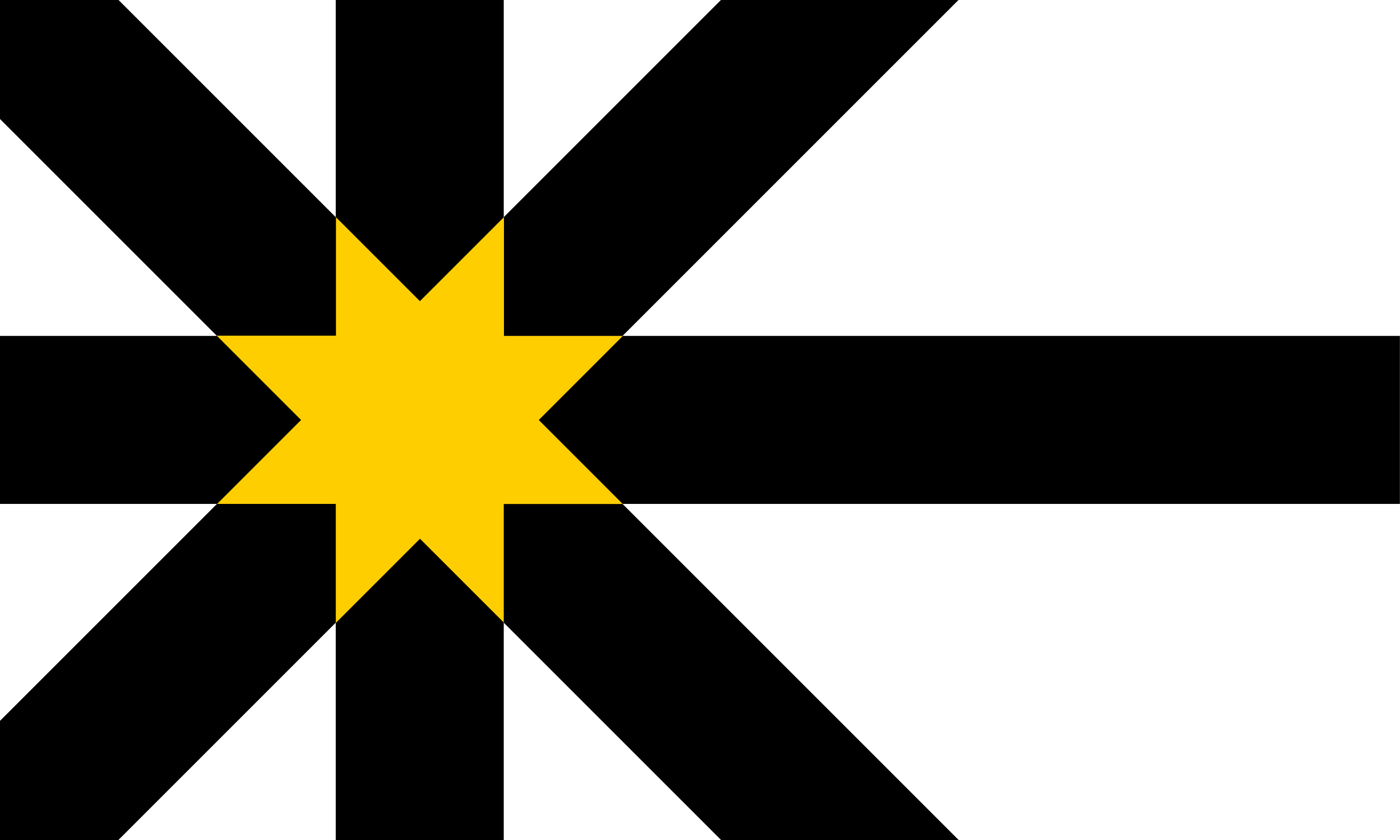 |
Sutherland is a maritime county, stretching across the north end of Scotland from the Atlantic to the North Sea. It is a Highland county, rough with mountain and moor. The north coast is a mixture of sandy bays and crags. There are two deep sea lochs, the Kyle of Tongue and Loch Eriboll. Coastal villages include Durness and Tongue. Beyond Loch Durness is the great rock of Cape Wrath, where the coast turns round to head south. This west coast is rocky and rough and sparingly inhabited. Coastal villages include Lochinver, Scourie and Kinlockbervie. Sutherland's North Sea coast is smoother, running from the Dornoch Firth to a little beyond Helmsdale. Dornoch is a seaside resort with the 13th-century Dornoch Cathedral. Bonar Bridge lies on the Kyle of Sutherland. The interior of Sutherland is high and bleak. There are lochs scattered throughout the hills, and peat lochans in the low ground. Lairg lies at the south-eastern end of Loch Shin. | County Profile |
| Tyrone | - | Tyrone is a rural county of Northern Ireland. The Sperrins, a range of quiet mountains and hills shared with Londonderry, occupy much of the north of Tyrone. They rise to 2,240 feet at Sawel. Elsewhere the county is almost entirely rural and agricultural. The main town Omagh sit in the centre of the shire at the confluence of the rivers Drumragh and Camowen. It has a quiet riverbank aspect. The flat peatlands of eastern Tyrone border the shoreline of Lough Neagh. Dungannon, in the south-east, was once the capital of the Kingdom of Ulster, overlooked by a hill on which a series of castles sat for many centuries. It is now a small market town. Strabane lies on the River Mourn in the north-west of the county, close to the Donegal border. | |
| Warwickshire | 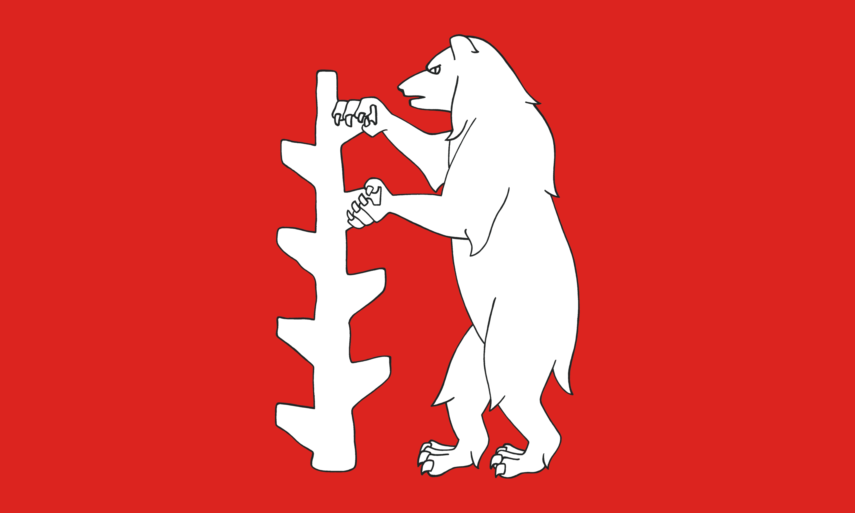 |
Warwickshire is an inland county in the English Midlands. The far south of the county lies in the Cotswold Hills with many fine Cotswold villages. North of this lies the Felden, an open, agricultural landscape with the small towns of Southam and Wellesbourne. Dunsmore, the area of the former great Dunsmore Heath, lies between Rugby, Coventry and Leamington Spa. Rugby is famous for its school. Royal Leamington Spa is a gorgeous Georgian spa town. The area north and west of the Avon is known as Arden. Once forest, it is a now landscape of farmland and parkland within which are several small towns and the two great cities. In Stratford-on-Avon, Shakespeare's birthplace remains almost as he would have known it. Warwick is home to two of England's greatest glories: Warwick Castle and the Beauchamp Chapel. Coventry is famous for its three cathedrals, Nuneaton for its associations with George Eliot. The north-west of the county is dominated by Birmingham, powerhouse of the Industrial Revolution. In the far north-west is Sutton Coldfield with its magnificent former Royal Forest of Sutton Park. | County Profile |
| West Lothian | - | West Lothian is a maritime county on the south bank of the Firth of Forth. The county's most famous landmark is the Forth Bridge which carries the Edinburgh–Aberdeen railway line across the Forth between South Queensferry to North Queensferry in Fife. The main coastal town is Bo'ness, a port grown to industrial town. The Antonine Wall ended here, at Kinneil. The royal burgh of Linlithgow gives the county its alternative name, Linlithgowshire. On Linlithgow Loch stand the remains of Linlithgow Palace, birthplace of Mary Queen of Scots. Between Linlithgow and Bathgate are the Bathgate Hills, the county's only upland area. The south of the county lies along the M8 corridor joining Edinburgh to Glasgow and has several industrial towns: Armadale, Bathgate, Whitburn, Broxburn and Livingston (partly in Midlothian), once a village but now a full-grown New Town. | County Profile |
| Westmorland | 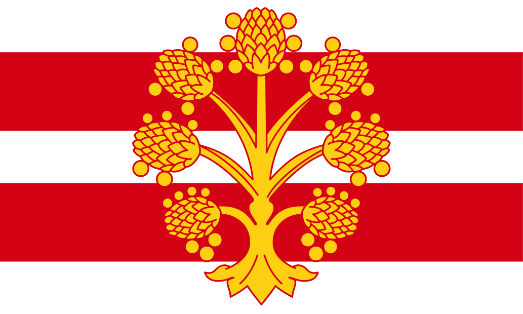 |
Westmorland is a mountainous county in the north-west of England. Many of the Lake District's greatest treasures lie within its borders, including the famous fells of Helvellyn, Bow Fell and Nethermost Pike; the great lakes of Windermere, Ullswater, Grasmere and Rydal Water; and the towns of Ambleside and Bowness-on-Windermere. To the east of Lakeland, separated from it by the valley of the Birk Beck and the Lune Gorge, are the Westmorland Dales, a remote and beautiful pastoral landscape with many stone circles and ancient monuments. In the north-east of the county, the Vale of Eden forms a broad, green vale between the Westmorland Dales and the Pennines, conveying its pretty river through Kirkby Stephen and the historic county town of Appleby. The south of the county is relatively low lying, including the valleys of the rivers Kent and Lune. Kendal is the home of Kendal mint cake. Westmorland has a short coastline with Morecambe Bay, around the Kent estuary. | County Profile |
| Wigtownshire | - | Wigtownshire is a maritime county in the far south-west of Scotland, between the Solway Firth and the North Channel. The west of the county is comprised of the hammer-headed peninsula the Rhinns of Galloway. The rounded northern headland ends at Milleur Point and the southern headland is the Mull of Galloway. Between the Rhinns and the main body of the county are two bays; Luce Bay a broad expanse to the south with 10 miles of sheltered sandy beach, and the more enclosed Loch Ryan to the north, along which are the ferry ports Stranraer and Cairnryan. The south-east of the county comprises The Machars, a great triangular peninsula between Wigtown Bay and Luce Bay. At the southern end is Whithorn, once site of a major Anglo-Saxon abbey. Wigtown itself, at the top of Wigtown Bay, has numerous second-hand bookshops. Newton Stewart spills over the River Cree into Kirckcudbrightshire. In the north-east, the county trespasses into the Southern Uplands. | County Profile |
| Wiltshire |  |
Wiltshire is an inland county in the south of England. The City of Salisbury lies in the county's south-east, a mediæval "new town" built around an ornate cathedral. Nearby is the ancient county town of Wilton, location of the magnificent Wilton House. Salisbury Plain stretches across almost the entire width of the county, home to Stonehenge and many other ancient landscape features. North of the Plain, the Vale of Pewsey is a beautiful agricultural landscape of small villages and fertile fields. To its north, the chalk hills of the Marlborough Downs sweep across the county, creating a hauntingly beautiful landscape littered with evidence of forgotten peoples. The most famous monuments are the Avebury ring and Silbury Hill. In the north-east of the county is Swindon, an ancient place but transformed by the Great Western Railway. The north-west lies in the Cotswolds, Malmesbury being a delightful Cotswolds town. The River Avon flows through the west of the county - Chippenham, Melksham, Bradford on Avon and Trowbridge lying along its valley. In the south-west are the garrison town of Warminster and Westbury, famous for its White Horse. | County Profile |
| Worcestershire |  |
Worcestershire is an inland county in the English Midlands. The centre of the county comprises the fertile lowland plain drained by the Severn and Avon and their tributaries, the Stour and Teme. Worcester itself stands on the Severn and is dominated by its grand cathedral. In the south-east of the county the pleasant Vale of Evesham provides excellent soil for orchards and market gardening. Evesham itself was founded around an early 8th-century abbey. The far south-east of Worcestershire lies in the Cotswolds, Broadway being known as the "Jewel of the Cotswolds". In contrast, the north-east of the county is urban in character, including the Black Country town of Oldbury, many of Birmingham's outer southern suburbs and the towns of Halesowen, Stourbridge, Bromsgrove and Redditch. Even in this corner of the county there remain havens of peace in the Clent Hills and the Lickey Hills. The north-west of the county comprises unspoilt countryside, much of it in the Teme valley. In the south-west are the pretty Malvern Hills. Great Malvern is a lovely spa town. | County Profile |
| Yorkshire |  |
Yorkshire is a maritime county in the north of England, the largest county in the Kingdom. Since the Viking era, Yorkshire has been divided into three ridings, whose boundaries meet at the walls of the ancient city of York. York itself is a delight, with its mediæval streets, its castle and York Minister. The East Riding stretches from the Ouse to the North Sea, from the Humber to the Derwent valley. On the Humber is the great maritime city of Kingston upon Hull. North is Beverley, with its famous Minster. The markets towns of Driffield and Market Weighton lie among the hills of the Yorkshire Wolds. On the coast are the resorts of Filey, Bridlington and Hornsea. The Holderness peninsula separates the Humber from the North Sea. The North Riding stretches from the Pennines to the North Sea, from the valleys of the Derwent, Ouse and Urr up to the Tees. On the coast are the resort of Scarborough and the ancient port of Whitby. Middlesbrough lies at the mouth of the Tees. The North York Moors lie in the east of the North Riding, the Howardian Hills to their south. The Pennines lie in the west. The Yorkshire Dales are renowned for their beauty. In Swaledale are the old towns of Richmond and the immemorial garrison town of Catterick. Wensleydale is noted for waterfalls and delightful villages. The Vale of Mowbray, the floodplain of the Swale, runs through the centre of the North Riding, between the hill groups. In it are the market towns of Northallerton and Thirsk. The West Riding has two major urban areas in its south-east: around Leeds, Bradford and Wakefield and around Sheffield, Rotherham and Barnsley. In the lowland Vale of York, Ripon has a fine cathedral. Harrogate is a popular spa town. Further north, some of the loveliest of the Yorkshire Dales are in the West Riding, including Nidderdale and Wharfdale. The West Riding stretches far to the west at Sedbergh and at the Forest of Bowland. Craven is a distinctive area of limestone hills. Saddleworth lies to the west of the Pennines. |
County Profile |
© Historic Counties Trust 2025 · Registered Charity No. 1114371 · enquiries@historiccountiestrust.co.uk · About Us